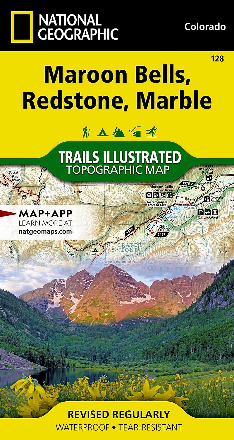
Maroon Bells, Redstone, Marble Map (National Geographic Trails Illustrated Map, 128)
Product ID: 13436864
Buy anything from 5,000+ international stores. One checkout price. No surprise fees. Join 2M+ shoppers on Desertcart.
Desertcart purchases this item on your behalf and handles shipping, customs, and support to Thailand.
• Waterproof • Tear-Resistant • Topographic Map Colorado's Maroon Bells are the most photographed peaks in North America. National Geographic's Trails Illustrated map of Maroon Bells, Redstone, Marble offers unparalleled detail for outdoor enthusiasts exploring the aspen forests, clear creeks, high alpine lakes, and towering granite peaks of this magnificent region. Created in partnership with local land management agencies, this expertly researched map features key areas of interest including White River and Gunnison national forests; Raggeds and Maroon Bells-Snowmass wilderness areas; Crystal and Roaring Fork rivers; Conundrum Hot Springs; and Snowmass Ski Area. With miles of mapped trails, this map can guide you off the beaten path and back again. Cyclists will appreciate the detail paid to the many hard surface and mountain bike trails in the region. The West Elk Loop Scenic Byway is noted for those wishing to take in the scenery by car. The map base includes contour lines and elevations for summits, passes and many lakes. Many recreation features are noted, including campgrounds, fishing areas, trailheads, alpine and cross country ski areas, and snowmobile trails. Survival tips and information about wilderness conduct are included as well. Every Trails Illustrated map is printed on "Backcountry Tough" waterproof, tear-resistant paper. A full UTM grid is printed on the map to aid with GPS navigation. Other features found on this map include: Capitol Peak, Elk Mountains, Gunnison National Forest, Maroon Bells-Snowmass Wilderness, Maroon Peak, North Maroon Peak, Pyramid Peak, Raggeds Wilderness, Snowmass Mountain, White River National Forest. Map Scale = 1:40,680 Sheet Size = 22" x 37.75" Folded Size = 4" x 7.5" Review: Great Maps! - These National Geographic maps are some of the best hiking and exploring maps available for the backcountry of Colorado. They are made of a sturdy material that seems to be pretty waterproof, and the level of detail and information provided is excellent. Maybe a bit pricey, but well worth the cost, in my opinion. Review: High-quality map - Crisp, high-quality map with declination (and year measured, plus annual degree change), and tons of detail on geographic features. Being water- and tear-resistant are huge pluses.









| Best Sellers Rank | #152,381 in Books ( See Top 100 in Books ) #229 in West Mountain United States Travel Books #315 in Maps (Books) #444 in Hiking & Camping Excursion Guides (Books) |
| Customer Reviews | 4.5 out of 5 stars 101 Reviews |
D**R
Great Maps!
These National Geographic maps are some of the best hiking and exploring maps available for the backcountry of Colorado. They are made of a sturdy material that seems to be pretty waterproof, and the level of detail and information provided is excellent. Maybe a bit pricey, but well worth the cost, in my opinion.
T**.
High-quality map
Crisp, high-quality map with declination (and year measured, plus annual degree change), and tons of detail on geographic features. Being water- and tear-resistant are huge pluses.
R**D
Heading outdoors!!
Just received my Maroon Bells map. As usual, National Geographic maps never disappoint. Very easy to read. If I were to have a complaint about this map. The only thing is that this map doesn't have mileage markings. Nothing a piece of string and a marker can fix.
J**1
Great maps
At first glance I thought this map was too large a scale to be useful as a backcountry map so I bought the same topo maps from the USGS. Much to my surprise, the topo's seemed faded and difficult to read compared to the Trails Illustrated map. One has to decide for themselves how much detail they require for the type of hiking they are planning. We stayed on marked trails most of the time and only used the Trails Illustrated map for our hike up to see the Maroon Bells and then over to Snowmass Lake on a 3 night backpacking trip, it was great! We had no problems finding our way, even over the high passes. The map even has a nice waterproof coating that kept it looking like new after our trip. These are great maps for everyday use hiking and camping but if you are looking for that 'needle in the haystack' on a mountain you may want to hold out for the old reliable topographic maps from the USGS.
C**.
Great product!
I use this for hiking and it works great for what I want it to do!
J**O
but whats the fun in that
Listen, you probably can explore this area without the map following the obvious trails and such, but whats the fun in that? This was really useful in understanding the area whilst hiking it. Plus, when your friends are over for beer you can bust this bad boy out and become Captian Braggart of the SS Snowmass.
P**P
Not up to National Geographic standards
National Geographic topographic maps are usually the gold standard for hiking and camping, but the Maroon Bells, Redstone, Marble map (2005 revision) is a disappointment. As others have mentioned, the map does not include mileage estimates between trail junctions or other waypoints. Given the frequency of switchbacks that are not depicted on the map, my colleagues and I found in a recent hike (July 2018) that we were consistently underestimating the distances. Even more frustrating, some trails differed dramatically in route from that depicted on the map. In particular, both the West Snowmass Trail (2187) and the Northfork Cutoff Trail (1976) were inconsistent with the map without any appearance of recent rerouting. This inaccuracy could be problematic when bushwacking towards a trail or junction. You could be off a half-mile or more if you are estimating from the map.
J**N
Good map!
The map is printed on good quality paper, easy to read!
Trustpilot
3 weeks ago
2 weeks ago