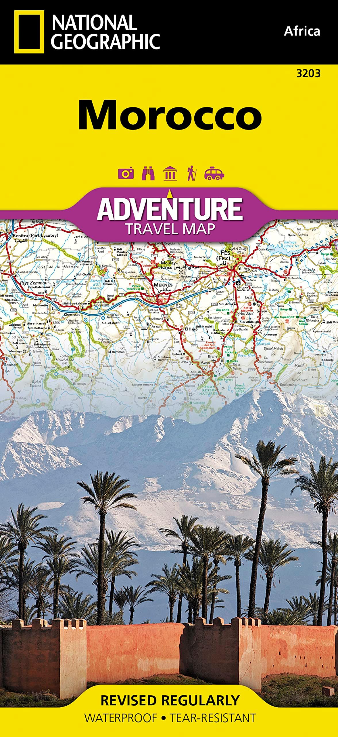

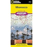
Morocco Map (National Geographic Adventure Map, 3203)
Product ID: 2752691
Desertcart purchases this item on your behalf and handles shipping, customs, and support to Thailand.
• Waterproof • Tear-Resistant • Travel Map National Geographic's Morocco Adventure Map provides global travelers with the perfect combination of detail and perspective, highlighting hundreds of points of interest and the unique and exotic destinations within the country. This expertly crafted map includes the locations of thousands of cities and towns with an index for easily locating them, plus a clearly marked road network complete with distances and designations for motorways, dual carriageways, major roadways, scenic routes, and more. In addition to typical sites of interest such as World Heritage sites, national parks, mosques, churches, and archeological sites, this map includes Morocco's many casbahs, and marabouts, making it invaluable to travelers hoping to experience the country's rich history and culture. Beaches, yachting harbors, and areas popular for fishing and surfing dot Morocco's extensive Mediterranean and Atlantic coastlines. Other recreational destinations such as ski resorts, golf courses, spas, caves, and oases are included as well. Morocco's northern half is shown on the front side of the print map and includes the cities of Tangier, Tetouan, Fez, Rabat, Casablanca, and Marrakesh. The reverse side of the map covers the southern portion of the country and includes a large inset map of Western Sahara. The Kingdom of Morocco is a part of the Maghreb region of North Africa that includes Tunisia, Algeria, Mauritania, and Libya with which it shares historical, cultural, and linguistic ties. Primarily a nation of farmers, the country is dominated by the Atlas Mountains that separate the fertile coastal regions from the harsh Sahara. These high, rugged mountains helped protect Morocco from colonization until the early 20th century when the French and Spanish brought their influence to the Islamic region. Every Adventure Map is printed on durable synthetic paper, making them waterproof, tear-resistant and tough — capable of withstanding the rigors of international travel. Map Scale = 1:1,000,000 Sheet Size = 37.75" x 25.5" Folded Size = 4.25" x 9.25" Review: Beautiful - Beautiful map that i enjoyed having for country overview in Morocco. Review: The Big Picture - This map was very helpful on our recent trip to Morocco. The detail was great. Maps on phones are nice but sometimes a “hard copy” is nice just to get the big picture.


| Best Sellers Rank | #130,947 in Books ( See Top 100 in Books ) #181 in Wall Maps #3,668 in Travel (Books) |
| Customer Reviews | 4.7 out of 5 stars 199 Reviews |
L**.
Beautiful
Beautiful map that i enjoyed having for country overview in Morocco.
V**2
The Big Picture
This map was very helpful on our recent trip to Morocco. The detail was great. Maps on phones are nice but sometimes a “hard copy” is nice just to get the big picture.
B**Y
Good detail and quality construction
I ordered this map for a recent trip from Marrakech to Merzouga (Erg Chebbi) in the east of Morocco. This map was excellent in terms of detail and stood up well to lots of refolding. There are many villages along main roads that are not marked on this map, but they are also missing from other places like Google and Bing Maps too. I would still recommend that you have a GPS unit for trips in the east as many hotels offers GPS coordinates.
D**S
A great and faithful traveling companion
This is a handy and durable traveling companion. The writing is clearly legible and the map itself fits comfortably in the side pocket of my camera bag. It was great for me to mark all of the locations that I visited with a pen and then use my scribblings for reference when I wrote about my travels later. I also did not have to worry if it rained as the paper is waterproof and tear resistant. Who needs an expensive GPS device that can be stolen when you can have one of these? Long live real maps!!
B**E
Well Done, National Geo
This is one detailed and very well made map which won't tear as a result of the use of tear resistant material (seems like a combination of paper and plastic). Lots of dirt roads, scenic highways and since it's a huge, two-sided map, the kms/inch ratio is high (1"=25 Km or 15.5 miles), so no squinting is necessary. I'm planning to take it on a road trip to Morocco in a few months and it has been a great trip planning tool. Will also be fun to hang it on the wall when I return, since I know it's gonna return fully intact.
M**S
It's a map, why is there a review
It's a road map, there shouldn't be a need for a review of this.
G**Y
Best map of Morocco
This is a great map for anyone who plans on doing their own driving while in Morocco. First, it is plasticized, so it doesn't tear, and it folds up again easily. It is very accurate. It has the great feature of indicating points of interest and tourist sights in an easy to understand format. Such a good map that I will plan on purchasing it for any future travels where we intend to do,our own driving.
R**T
Good map
Good detailed road map
B**.
Sehr gute Karte für Offroader
Wie immer wieder eine perfekte Map für die Planung unserer Reisen, alle wichtigen Dinge verzeichnet.
J**K
good detailed map
Its a map....and a good one...thats all
J**N
Bonne qualité impeccable
Bonne qualité Carte détaillée Bien complet Je peux la conseiller 👍😉
S**A
Ottimo prodotto!!
Ottima cartina, fatta bene e dettagliata! La consiglio!
P**K
Size does matter
Goed formaat
Trustpilot
2 months ago
2 weeks ago