Description
🗺️ Own the Room with the Ultimate UK Map Statement
- MAXIMIZE YOUR WORKSPACE IMPACT - A commanding 84.1 x 118.9 cm size ensures every UK detail is crystal clear, perfect for strategic planning or office décor.
- READY TO DISPLAY BUILT TO LAST - Creaseless packaging and premium lamination guarantee your map arrives pristine and stays flawless through daily use.
- EFFORTLESS UPDATES ANNOTATIONS - Front sheet lamination lets you write, wipe, and rewrite with dry erase markers—ideal for dynamic meetings and brainstorming sessions.
- VIBRANT ADMINISTRATIVE PRECISION - Distinct colours highlight counties, unitary authorities, boroughs, and districts for instant geographic insights at a glance.
- EXPERTLY CRAFTED CARTOGRAPHIC EXCELLENCE - Produced by Oxford-based Maps International with 50+ years of mapping mastery, blending accuracy with stunning design.
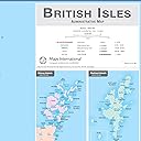
This large British Isles administrative map (84.1 x 118.9 cm) from Maps International features detailed political boundaries with vibrant colour coding of counties, boroughs, and postcode areas. Finished with a durable front sheet lamination, it offers a write-on/wipe-off surface perfect for office or classroom use. Crafted by expert cartographers in Oxford with over 50 years of experience, it arrives creaseless and ready to elevate any professional environment.